
A swirling funnel cloud over northern Delaware met real damage on the ground, and officials used set rules to separate warning from proof.
Story Highlights
- National Weather Service systems log tornado facts from surveys and trusted reports.
- Local outlets reported a New Castle County tornado with visible damage to signs, trees, and buildings.
- Radar rotation supported warnings, while ground checks confirm if a tornado touched down.
- Official databases organize events by county and type to keep public records consistent.
What Officials Track And Why It Matters
National Weather Service offices document severe storms using a standard process. Staff gather reports from trained spotters, emergency managers, police, and the media. Teams add data from damage surveys when needed. They record where and when the storm hit, how strong it was, and what it damaged. These records help confirm if a funnel cloud actually touched down and became a tornado. The goal is clear public data that can guide safety decisions and future planning.
Federal databases sort these events by county and event type. Tornadoes, hail, flash floods, and severe wind go into county records. Larger hazards, like floods and drought, use broader forecast zones. This setup lets people search by location and date to see what happened during a storm. It also keeps reports consistent across states. Anyone can use the database to check how a storm was logged and what evidence backed the entry.
What Happened In Northern Delaware
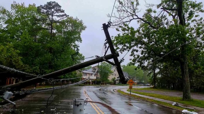
Television reports showed a funnel cloud over northern Delaware as storms rolled through the area. Reporters cited damage in New Castle County, including a large hotel sign ripped from its frame, trees toppled, and broken windows and siding. Those are the kinds of clues survey teams use to decide if winds spun in a tight, damaging path or blew straight along a line. That call determines whether the event is logged as a tornado or severe thunderstorm wind.
Radar scans during the storm showed strong rotation over parts of New Castle County. Forecasters look for a tight “couplet,” where winds move in opposite directions close together. That is a key sign of a possible tornado and can trigger a warning. But a warning is not the same as a confirmed tornado. Crews still check ground damage and credible reports to decide if a rotating cloud actually reached the surface and caused a track of harm.
How A Tornado Gets Confirmed
Survey teams follow clear guidance to separate tornado damage from straight-line wind. They look for a narrow path with twisting or converging debris. They map the start and end points and measure path length and width. They also assign an Enhanced Fujita rating based on how structures and trees failed. If damage is limited or unclear, they may log the event as severe wind instead. These steps create a common standard across the country.
New Castle County storm history shows how final labels can differ from live coverage. A storm may show clear rotation on radar and still end up logged as thunderstorm wind if damage does not match a tornado path. The database allows searches by county and date to see what was recorded and why. This helps the public, insurers, and city leaders plan repairs and reduce risk the next time storms threaten Delaware and nearby states.
Why This Resonates With Voters
People across the political spectrum want straight answers when danger hits home. Families need to know if the threat was a tornado or severe wind. Truckers, small businesses, and homeowners need reliable records for insurance and rebuilding. When officials follow a clear system, the public can check the facts without spin. That trust matters when many feel government misses the basics. Accurate storm logs do not fix every problem, but they protect lives and wallets when minutes count.
Sources:
facebook.com, preview.weather.gov, weather.gov