
New York declared a State of Emergency across eight counties as a powerful coastal storm threatens flooding, outages, and dangerous winds through the weekend.
Story Highlights
- Governor Kathy Hochul declared a State of Emergency for New York City, Long Island, and parts of the Lower Hudson Valley.
- Officials warned of coastal flooding, strong winds, and possible power outages from Friday through Sunday.
- Emergency operations are active, with utility and response crews on standby for rapid deployment.
- Forecasters say the storm’s exact track could shift local impacts, but coastal hazards remain likely.
Emergency Declaration and Immediate Risks
Governor Kathy Hochul declared a State of Emergency for Bronx, Kings, Nassau, New York, Queens, Richmond, Suffolk, and Westchester Counties. The state cited strong winds, heavy rain, and dangerous coastal flooding as the key threats. The order aims to speed help if roads flood or power lines fail. State and local agencies asked residents to avoid unnecessary travel and to keep phones charged. The window of concern runs through Sunday, when peak tides could overlap with onshore winds.
Officials warned that coastal flooding and beach erosion are likely in vulnerable areas. Long Island’s South Shore, New York City shorelines, and low-lying parts of Westchester face the greatest flood risk. High surf could push water into bays and inlets while strong gusts down trees. Those hazards raise the chance of localized outages. The Governor’s office urged people to move vehicles from flood zones, clear storm drains, and prepare a go-bag with water, food, and needed medicine before conditions worsen.
What Forecasts Say About Timing and Track
National Weather Service discussions said recent model runs show better agreement on the storm’s path, but warned small shifts can change which neighborhoods see the worst rain and wind. That means two close-by towns could see very different outcomes. Even with that uncertainty, forecasters kept focus on coastal flooding and damaging gusts near the water as the most likely hazards. The highest impacts cluster around high tide cycles and persist into late weekend hours.
Media and forecast outlets stressed that early action saves lives even when the exact track is not locked in. They highlighted a common coastal pattern: strong warnings paired with honest notes about uncertainty. The goal is to get people ready while there is still time to act. New Yorkers have seen this before with nor’easters that wobble near the coast. A small jog can mean heavier bands, higher surge, or a quicker exit. Preparedness bridges that gap when nature does not give perfect clarity.
How the State Is Positioning Resources
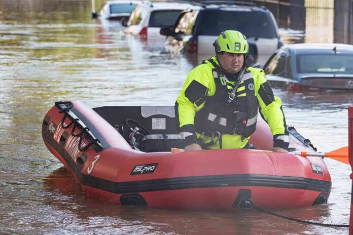
The state activated emergency operations and coordinated with local governments, utilities, and transit agencies. Crews staged pumps, barricades, and high-water vehicles in flood-prone corridors. Utility companies prepared extra line workers to restore service if winds topple branches onto wires. Transportation teams warned that standing water could close parkways and cause subway slowdowns. Officials asked drivers to turn around at flooded roads and reminded riders to check alerts before heading out this weekend.
#BREAKING
NEW YORK CITY, NY (NP) — New York City Officials are monitoring the situation with the Nor’ Easter as it approaches the 5 Boroughs #nyc #ny pic.twitter.com/aAzxStJkXI— National Presse (@NPWire) September 26, 2026
For families, this storm is another stress test of basic systems that many feel have frayed. People across the political spectrum worry that infrastructure, from power grids to drainage, lags behind rising risk. This weekend offers a simple plan: clear gutters, secure loose items, keep devices charged, and check on neighbors who may need help. That local action pairs with the state’s emergency steps, and together can keep damage down when water, wind, and tides line up.