

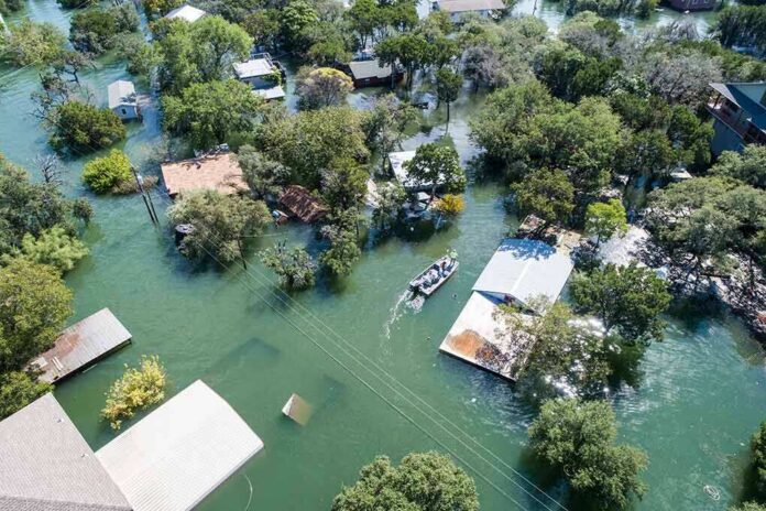
Ocean water poured into garages, streets, and alleyways on Newport Beach’s Balboa Peninsula as Tropical Storm Rachel pushed toward the Southern California coast this weekend.
Story Snapshot
- The National Hurricane Center issued a Tropical Storm Watch for part of the Southern California coast as Rachel tracked northeast toward the region.
- Federal forecasters warned of maximum sustained winds near 50 mph and “life-threatening surf” along the coastline.
- Local TV crews filmed flooded garages, streets, and back-bay areas in Newport Beach and Long Beach as tides rose.
- Forecasters linked the surf threat partly to swells generated by Rachel, alongside other coastal flooding risks already in play.
- Officials stressed the storm’s track and strength could still shift, since tropical systems rarely hit a forecast with pinpoint accuracy.
Storm Watch Covers Southern California Coast
The National Hurricane Center issued a Tropical Storm Watch for the Southern California coastline, stretching from the U.S.-Mexico border north to the San Diego/Orange County line. The agency’s 8 a.m. advisory on October 9 made the warning official, giving coastal residents and emergency managers a clear signal that hazardous conditions were possible within the watch area in the coming hours.
By 11 a.m. that same day, the National Hurricane Center reported Rachel moving northeast at about 5 mph, with the storm’s forecast track carrying it toward the northern Baja California Peninsula or Southern California late Saturday or early Sunday. Forecasters clocked maximum sustained winds near 50 mph, with higher gusts possible as the system approached land.
Dangerous Surf and Coastal Flooding Forecast
Hurricane forecasters did not limit their warning to wind and rain. The October 9 advisory specifically flagged swells tied in part to Rachel, warning they would build along the Southern California coast and create “life-threatening surf” conditions for swimmers and surfers. Earlier advisories had already flagged the risk of dangerous rip currents and “minor to moderate coastal flooding” well before the storm’s closest approach.
That warning didn’t come out of nowhere. A day earlier, an 8 p.m. advisory on October 8 had already told Southern California residents to keep watching Rachel closely, forecasting a turn to the northeast and noting that formal Tropical Storm Watches could follow. That earlier alert gave coastal communities roughly a full day of lead time before the watch became official.
Water Reaches Newport Beach Streets
Television crews on the ground captured the hazard turning real. KTLA 5 reporters filmed flooding in Long Beach, Newport Beach, and surrounding back-bay areas, showing seawater pushing into garages, streets, and alleyways as tides rose under a coastal flood advisory. ABC7 crews separately documented coastal flooding alongside surf reaching 4 to 8 feet and dangerous rip currents battering the shoreline as Rachel’s effects spread north.
Video from the Balboa Peninsula showed high tides washing directly into residential streets, a scene that matched the kind of coastal flooding federal forecasters had been warning about for days. Local crews described rising water levels pressing into neighborhoods that sit just steps from the harbor and open coast, areas long known for their exposure to storm surf and elevated tides.
Forecast Uncertainty Remains Part of the Picture
Tropical cyclone forecasts carry built-in uncertainty, even when watches and warnings are issued with confidence. Hurricane forecasters routinely note that a watch means hazardous conditions are possible, not guaranteed, within the specified area, and storm tracks can shift in the final day before landfall. That doesn’t change what residents saw on the ground, but it’s a reminder that storm paths and strength can still move before a system fully arrives.
Orange County California – Coastal Risk Analysis and Forecast
Fresh nearshore data now confirms a powerful 20-second SSW component in Orange County; Sunday remains HIGH with localized SEVERE impacts possible.
Forecast issued: Saturday, October 10, 2026 — 3:30 AM PDT
Current…— OC Beach Status (@OCBeachStatus) October 10, 2026
For now, the images out of Newport Beach line up with what the National Hurricane Center had been telling Southern California for days: watch the surf, watch the tides, and don’t underestimate a storm still a day or more from making its closest approach. Coastal residents from the Mexican border to Orange County were told to stay alert as Rachel continued its slow push toward the region.
Sources:
thegatewaypundit.com, nhc.noaa.gov